
This was the largest piece of land acquired under the PWA in the Maniapoto rōhe (region). It was strongly opposed by Ngāti Maniapoto and the Crown has since acknowledged that taking the land was a Treaty breach - view the related cabinet paper and documents on Govt.nz.
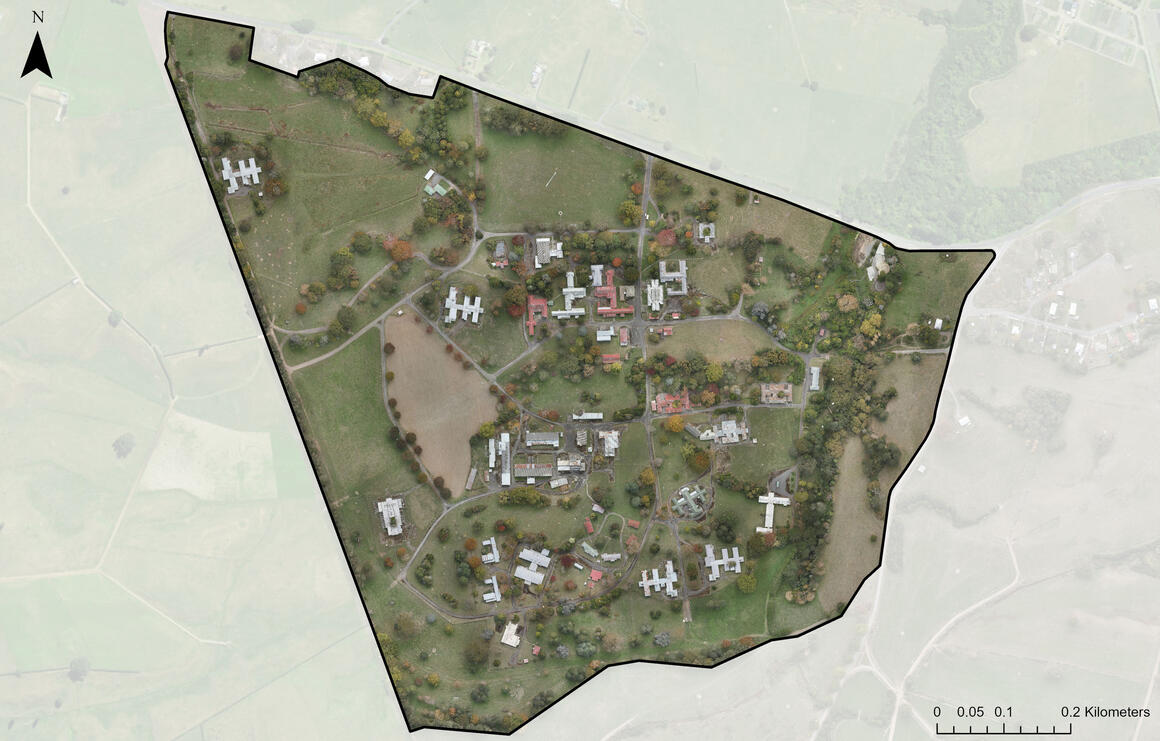
What the site contains
The hospital site is around 80 hectares in size and contains:
- 74 buildings
- a swimming pool
- 8 substations
- 14 kilometres of underground services (pipes)
- a closed landfill
- roading.

Eagle Technology, Land Information New Zealand, GEBCO, Community maps contributors.
Years of operation and transfer
Tokanui opened in 1912 and operated for over 85 years before closing in 1998 following a move from residential to community-based mental health care.
The site was transferred into the Treaty Settlements Landbank (managed by the Ministry of Justice at the time) in 1999 to be used as redress to settle historical Treaty claims.
We took over management of the Landbank in 2016 and received the hospital in this transfer as well as many other sites.
Any future use of the whenua will be for Ngāti Maniapoto to decide.
Treaty Settlements Landbank
We manage around 900 properties in the Landbank including former prisons, schools and houses.
Land enters the landbank when it is no longer needed by the Crown and can be used as either cultural or commercial redress in a Treaty settlement.
More information on the Treaty Settlements Landbank and the Māori Protection Mechanism.