
When accretion is being claimed, the claimed portion is incorporated into the new primary parcel. The remainder of the unclaimed hydro parcelis a balance parcel. CSR 2021 require the former water boundary position to be depicted with an estate boundary line (Rule 97(7)).
How do I capture an accretion parcel?
- Go into Plan Generation/Define Diagrams/Spatial window and use the Select Existing Line tool to bring in the underlying RT boundaries.

- Select the RT (arrow) button. RT lines will be highlighted in red in the Spatial window. Use your mouse and hold down the shift key to select all the relevant red lines you require.
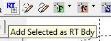
- Select the RT+ button and the selected lines will be added to your diagrams.
- In the Layout Sheets, depict the Accretion parcel inside the RT boundary lines by adding User Added Text showing the word 'Accretion' and the area of accretion Rule 41(3). Note that the captured area of the new primary parcel will include the area of the original land plus that of the accretion.


In the case where an area of accretion being claimed encroaches onto land on the opposite side of the water body (when plotted from underlying data), there could be a legitimate overlap in the cadastre. In this case, set the affected land as ‘encroached’.