
Map image Ross Sea 1:3 Million
These maps are not available in paper format.
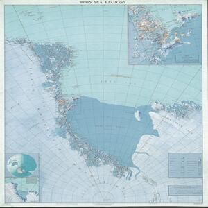
Ross Sea, 1:3 Million

Map images of the Antarctic Topo50 Map series at 1:50,000 scale
You can download these images free as TIFF files. If you want georeferenced image files and vector data you can access these from the LINZ Data Service.
We produce these maps using:
- the Ross Sea Region Geodetic Datum 2000 (RSRGD2000)
- the McMurdo Sound Lambert Conformal 2000 (MSLC2000) projection.
Paper maps
You can order paper versions of ANTopo50 ME13, ME14, MF13 and MF14 through major map and online map retailers.