Mariners are cautioned against taking a vessel through Te Aumiti / French Pass against the stream.
Vessels sometimes do not answer the helm, owing to the stream eddies acting on the bow, and there is danger of meeting a vessel coming from the opposite direction which is not visible in sufficient time to prevent collision.
Powered vessels of moderate size can, with prudence, pass through at slack water or with the tidal stream and in doing so save 15 miles of distance and avoid the heavy cross sea that is frequently met northward of Rangitoto ki te Tonga (D'Urville Island) and Stephens Island. Local knowledge is highly desirable.
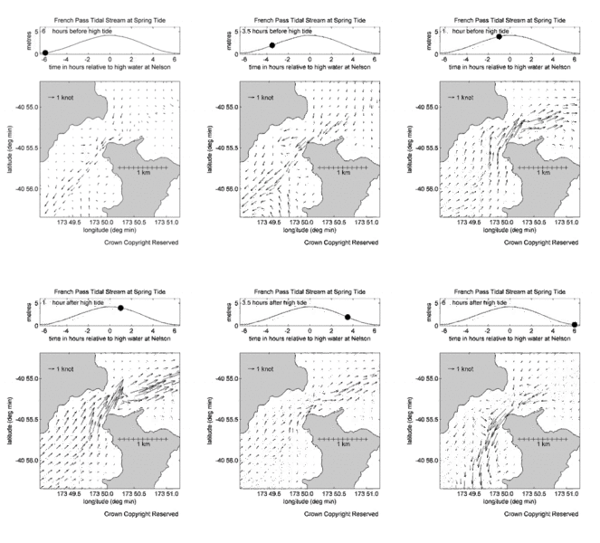
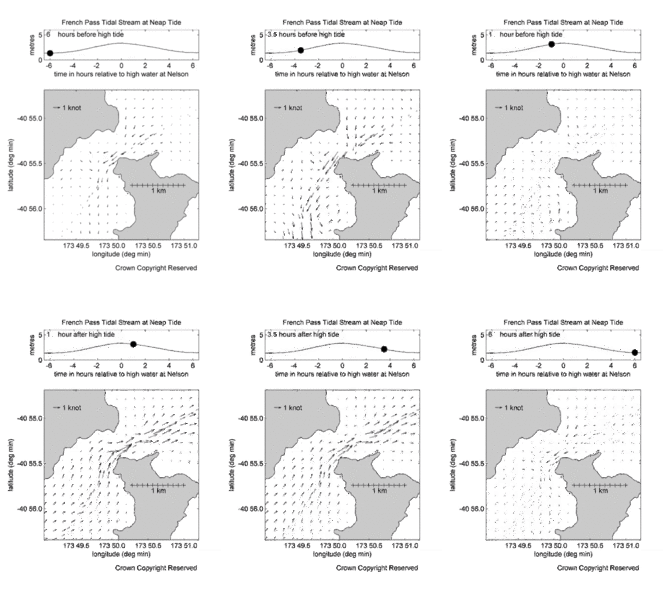
The flood and ebb streams attain rates of 5 to 7 knots and do not set directly through the narrow channel but across it. The flood stream sets in a south-westerly direction as far as the narrows and then along the shore between Channel and Rock Cod Points. The ebb stream sets in the opposite direction. See the tidal arrows shown on the chart (NZ 6151). Slack water lasts about 20 minutes.
The extraordinary irregularity of the sea bottom, together with the narrowness of the channel, creates many eddies in this area. Care must be taken to prevent a vessel being swung round on to Collinet Point by the eddies.
Predictions
Times and direction of tidal streams.
Note that the times used in the tidal stream predictions have been adjusted to New Zealand Daylight Time when daylight saving is observed.
Te Aumiti / French Pass predictions (CSV)
Te Aumiti / French Pass predictions (PDF)
Diagrams and animations
Diagrams showing the direction and rate of tidal streams at hourly intervals during average spring and neap tide conditions are also available below, along with animations of spring and neap tides.


Disclaimer
The tidal stream predictions on this website are not official tide tables as specified in Maritime Rules Part 25 Nautical Charts and Publications (pursuant to Section 36 of the Maritime Transport Act 1994).
Toitū Te Whenua accepts no liability for any direct, indirect, consequential or incidental damages that result from any errors in the information, whether due to Toitū Te Whenua or a third party, or that arise from the use, or misuse, of the information available from this site.