Kia ora
Ki ngā rangatira, ngā manaakitanga i runga i ngā ahuatanga o Matariki me Puanga. Ko te kaupapa o te pānui nei, ka whakapakari te hononga o Te Tiriti. I a wā, ka tuku atu mātou he pānui ki a koutou ki te whāngai te hononga. Mehemea he pātai āu, pātai mai, whakamōhio mai e te whānau!
Greetings
Welcome to the second issue of our quarterly panui. In this update, we share information about our services, products, and Treaty settlement work that may be useful to iwi and Māori. Each issue will focus on themes related to LINZ mahi. This edition highlights those areas that gather, disseminate or promote information on land related activities.
Supporting your journey – Upcoming Landonline workshop

We are hosting our first Landonline workshop on Wednesday 30 July from 12:00pm to 12:45pm.
The workshop will outline the types of information LINZ holds about whenua including overview of Landonline, Māori Land plans and modern and historical gazette notices.
If you would like to attend, please reach out to MCRTeam@linz.govt.nz
Relationship partners
Our Relationship Partners work to support the relationship between the Crown and Māori. We are committed to building meaningful connections and providing guidance and support including during the Treaty settlement journey.
Annual iwi Survey – Strengthening our relationships
Our annual iwi survey will be undertaken in August and supports our commitment to continuous improvement and obtaining iwi feedback. An email with information on the survey will be provided shortly.

Mapping the future – LiDAR elevation data for iwi and hapū
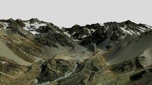
LINZ's National Elevation programme provides iwi, hapū, and communities with powerful tools to better understand and manage their landscapes, support land development, protect the environment, and plan regional infrastructure. Further details and access to the data will be available via the LINZ website.
Provincial Growth Fund LiDAR Elevation Data Capture Project

Strengthening emergency response capability
LINZ contributes to emergency preparedness by supporting cross-agency emergency management initiatives including providing critical mapping and geospatial data to help identify risks, inform responses and coordinate recovery efforts.
Geospatial support in an emergency
CIMS training is also available through Civil Defence and local Councils.

Ngā Poutama Matawhenua
Watch the recording of a special Ngā Poutama Matawhenua wānanga held on 13 June 2025.
Join Keith Holswich (Ngāti Rahiri, Te Atiawa, Taranaki) as he shares the powerful story of He Kete Mātauranga – a grassroots GIS system built by, for, and with hapū to protect, manage, and connect with their whenua.
View the June recording on Youtube
Keen to share?
If you know of others who would be interested in these updates, send them a link to the Pokapū subscription form.
Media contact
Email: media@linz.govt.nz