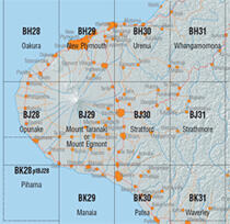
The sheet index diagrams show you the boundaries and names for each of the 451 Topo50 A1 portrait sheets, including the 6 Chatham Islands sheets.

Section of the Topo50 map sheet index
Sheet index diagrams
Where a printed sheet covers a small land area, one-third of the map area overlaps with the adjacent sheet. Sheets that overlap another sheet are shown with a dashed outline.
Topo50 sheet index diagrams and combined Topo50 and 260 sheet index diagrams showing Topo50 and 260 sheet lines are available for both the North and South Island.
Data available from the LINZ Data Service
You can download vector data versions of the Topo50 map sheet extents from the LINZ Data service: