
The project aims to produce the definitive map of the world ocean floor by 2030 and make it freely available to all. This will be achieved by combining all existing bathymetric (depth to the seafloor) data and encouraging efforts to collect and submit new data to enable the seafloor to be mapped at a global resolution never achieved before. Historically less than 20% of the world’s ocean floor is adequately mapped. The project is aiming for the bold target of 100% coverage by 2030.
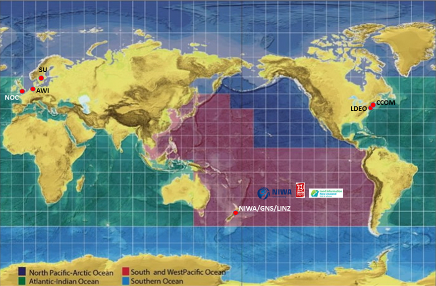
The world’s oceans have been divided in to four regions. Each region has a data centre that is responsible for championing mapping activities, assembling and compiling bathymetric information and collaborating with existing mapping initiatives within its region.
New Zealand lies within the South and West Pacific Region (SaWPac), an area equivalent to a quarter of the world’s oceans - some 124 million square kilometres. It covers the Pacific Ocean from South America to Australia and the western part of the Northern Pacific Ocean to Japan, taking in the Exclusive Economic Zones of 39 countries and territories.
The data centre for SaWPac is hosted at the National Institute of Water and Atmospheric Research (NIWA) in Wellington. The data centre’s activities are coordinated by a technical management committee consisting of representatives from NIWA, Land Information New Zealand and GNS Science.

Project data centre areas