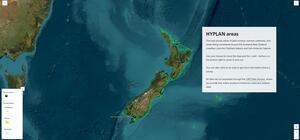
Due to the lead-in time needed for hydrographic surveys, we plan several years ahead. Survey locations are published in HYPLAN, which details priority areas and is reviewed annually.
View this video about how our hydrographic experts and suppliers capture data through seabed surveys to help improve nautical charts and knowledge of the marine environment.
https://www.youtube.com/watch?v=u4WB4Vq4Brc
Find out about our standards and specifications for hydrographic surveys
Find out about the types of data collected in a hydrographic survey.
Mapping Aotearoa's seafloor
We've created an interactive storymap to provide a visual demonstration of Toitū Te Whenua LINZ's seafloor mapping programme. You can view maps of HYPLAN areas and recent surveys as well as link to recent case studies. Surveys ‘in progress’ are where fieldwork is currently underway or the data from completed fieldwork is still being analysed.
View the Mapping Aotearoa's seafloor storymap

Image of the Mapping Aotearoa seafloor storymap.
HYPLAN
The priorities for our hydrographic survey and charting work over the next 5 to 10 years are set out in HYPLAN.
These priority areas are identified from an evidence-based assessment of maritime traffic and the adequacy and accuracy of New Zealand’s nautical charts. Risk assessments have been completed for New Zealand waters, the Sub-Antarctic Islands and a number of islands in the South Pacific region.
Regions that will benefit most from updated charts and navigation information are listed as priority regions. First published in 2017, we reviewed these priorities in 2019 and 2020 to reflect areas that have been completed. The latest edition holds a revised priority list removing completed areas from previous years and includes areas in the Sub-Antarctic Islands.
Hydrographic risk assessments
The priority regions in HYPLAN are based on the results of our hydrographic risk assessment for New Zealand and the Sub-Antarctic Islands. The risk assessment takes into account ship traffic, hazards and the age of existing navigational information to determine the level and location of navigational related risk.
New Zealand and Sub-Antarctic Islands Hydrographic Risk Assessments