Event date, time and location
Date: Friday 3 May 2024
Time: 9am - 5pm
Location: The meeting will be a hybrid event. Online participants will access streaming presentations. On-site participants will also have access to workshops, with the chance to visit the National Geohazards Monitoring Centre following the meeting.
The physical location will be GNS Science, 1 Fairway Drive, Avalon, Lower Hutt. GNS is accessible by public transport and is a 15 minute walk from Naenae train station. Free parking is available on site.
Event details
This meeting provides a forum to exchange knowledge and ideas to facilitate national collaboration and leverage opportunities to grow the value of marine geospatial investments and benefits for all Aotearoa. The meeting attracts a growing number of scientists and professionals including ecologists, geologists, hydrographers, spatial analysts, consultants, and more.

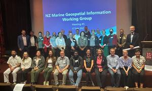
Attendees of the 2023 NZ MGI working group annual meeting
This year MGI 24 will bring together marine experts and geospatial specialists to celebrate five years of achievements and set joint priorities for upcoming years.
Programme
| Agenda item | Presenting organisation | Attendance |
|---|---|---|
| Session 1 | 9.00 am | ||
| Geospatial alignment to policy drivers, New Zealand’s case study | Consulting Where | online |
| IHO S-100, the new hydrographic geospatial standard for marine data | ICC Technologies | online |
| The NZ MGI work programme - Celebrating 5 years of achievements, road map updates and setting future priorities | NZ MGI working group | online |
| Morning tea | 10.30 am | in person | |
| Session 2 | 11.00 am | ||
| Enabling environmental data science and applications | Oceanum Science | online |
| Improvements in the mapping of commercial fishing effort | MPI | online |
| Electronic Navigational Charts and ArcGIS Maritime Server: Revealing the potential of the LINZ ENC Service beyond navigation | NZDF and Eagle Technology | online |
| Lunch | 12.30 pm | in person | |
| Session 3 | 1.00 pm | ||
| Seabed 2030 and the challenge to map the World’s Oceans | Seabed 2030 | online |
| Opportunities for coordinated seafloor mapping programmes and broader marine outcomes | Toitū Te Whenua LINZ | online |
| Afternoon tea | in person | |
| Final session | 2.00 pm | ||
| Workshop national coordinated seabed mapping programme | All in person attendees | in person |
| Refreshments and tour of the National Geohazards Monitoring Centre | in person | |
| End of day | 5.00pm |
This year, GNS Science Te Pū Ao will host the meeting with the generous sponsorship from:
If you would like to support the event, please contact the organising team at mgi24@linz.govt.nz.
Any event enquiries can also be sent to mgi24@linz.govt.nz.
Sponsors


