The Board has produced several publications about traditional and current place naming, which can be downloaded or purchased below.

Maps

Tangata whenua place names

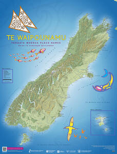
Maps of Te Waipounamu and Te Ika-a-Māui - second edition 2023
Tangata whenua place names of Aotearoa New Zealand, pre European settlement. Download the second edition of these maps and learn about the updates made in 2023.
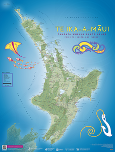
 

Preview image of the map of Te Ika-a-Māui
Map showing the place names given by tangata whenua throughout Te Ika-a-Māui, before European settlement

Maps of Te Waipounamu and Te Ika-a-Māui - first edition 1995
Tangata whenua place names of Aotearoa New Zealand, pre European settlement.


1st edition, 1995. Ngā Pou Taunaha o Aotearoa New Zealand Geographic Board contributed to a revised map and gazetteer compiled for the United Nations Group of Experts on Geographical Names (UNGEGN) Asia South East and Pacific South West Division.

Publications

This bilingual book tells the stories of early Māori discoverers, explorers and travellers from the first wave of migration waka, and the place names they gave. Each story has a map showing their journeys and the locations of the places named.
This companion book to the Māori Oral History Atlas focuses on ways of understanding Māori place names

Brochure, factsheet and flyers

This A3 PDF gives an overview of the New Zealand Geographic Board - Ngā Pou Taunaha o Aotearoa - The memorial markers of the landscape.
The New Zealand Geographic Board (Ngā Pou Taunaha o Aotearoa) Act 2008 updated the Board's roles and responsibilities and replaced the 1946 legislation that previously governed the Board's work. This factsheet gives information about the Act as of 2008.

New Zealand’s vast undersea area is largely unmapped. More than 1000 features on the ocean floor are named but there could potentially be thousands more.

New Zealand’s authority on place names, the New Zealand Geographic Board Ngā Pou Taunaha o Aotearoa (Geographic Board), is committed to restoring original Māori place names.

Consistent and accurate identification of place supports Antarctic science. Official place names assist with navigation and emergency responses including by use on topographic maps and hydrographic charts.

Copyright

We hold the copyright for these maps, books and other resources. If you wish to reproduce any part or whole of these publications, please contact the Board Secretary for permission. A suitable acknowledgement to the Board is required for any reproduction.

Contact the Board Secretary

Buying publications and maps

Limited print copies of our publications can be purchased from Blue Star.

Blue Star

Map retailers and other outlets may hold these maps to sell.
Search map retailers

Contact Kōrero whakapā