
Guidance for surveyors on boundary conflicts in greater Christchurch
LINZ has developed guidance to assist cadastral surveyors working in greater Christchurch when dealing with boundary conflicts arising from approved interim surveys.
Realigning the cadastre in Christchurch
In early 2017 LINZ updated the spatial representation in Landonline to reflect boundaries in their post-earthquake positions. The targeted area for realignment was the eastern side of Christchurch, as it had the most earthquake damage due to shallow ground movement.
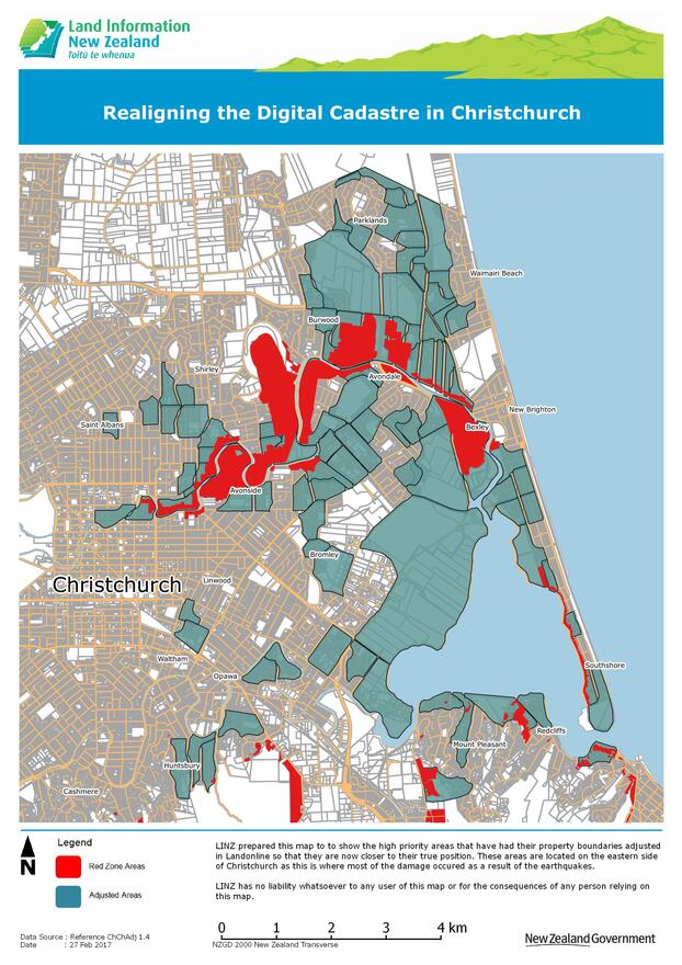

Coordinates were calculated in areas affected by shallow ground movement (shown blue on the map) that best reflect where survey marks and boundary positions are located after the earthquakes.
Geotechnical report on ground movements
In March 2015 LINZ commissioned a report from Tonkin and Taylor Ltd to provide background geotechnical information about ground movements that occurred as a result of the Canterbury Earthquake Sequence. The report:
- focuses on horizontal ground movements of most relevance for cadastral surveyors
- explains the key geological mechanisms
- outlines the data that is available on the Canterbury Geotechnical Database that relates to these mechanisms
- summarises the key features and limitations of the information that need to be considered when using the data.
The report does not attempt to delineate areas where ground movements may have an impact on cadastral surveys, nor does it propose any solutions for these issues.
Map indicating shallow surface movement
The map of indicative shallow surface movement in Christchurch shows the general extent of lateral shallow surface movement in Christchurch. It extrapolates movements that have been measured at a network of geodetic survey marks around Christchurch typically spaced hundreds of metres apart. Movement at the individual property level may be significantly more or less than the value indicated on the map.