LiDAR data coverage

Our National Elevation Programme provides open-source LiDAR based elevation data for most of New Zealand.

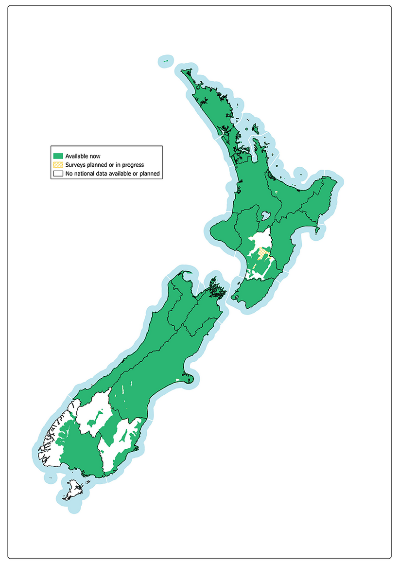
Data is now available for the green areas shown on the map below, and surveying is planned or underway for the cross-hatched areas. No data is available or planned for the white areas. 

The Elevation Aotearoa website provides more detail of the areas covered and when data will be available from surveys that are underway. It has interactive maps, use case examples, and guides for applying the LiDAR data.

Visit the Elevation Aotearoa website.

Map of New Zealand showing that LiDAR data is available for most of the country, as well as where surveying is planned or underway, and where no data is available.
Last updated