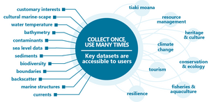
Robust management for data collection, storage, maintenance and publication facilitates data reuse. Interoperability is key to making MGI truly reusable.
MGI metadata
The use of metadata standards ensures consistency in how MGI is managed and published. The NZMGI WG has produced guidelines to support publication, discovery and reuse of NZ marine geospatial data.
MGI vocabulary
Consistent data vocabularies support discoverability, reuse and management of data. There are a considerable number of controlled vocabularies for marine data that vary in function, scope, capability and content. The NZ Marine Geospatial Metadata Guidelines includes links to several vocabulary options. Data can also be grouped in various ways. Based on work with both international groups and the NZ marine community, the MGI steering group recommends the following categories:
MGI case study library
See how MGI can be used to inform important decision-making and support our communities.

Survey
Share with others how the data you collect or reuse support improve management of the ocean and marine resources.
Flexible Assisting customary fishery management
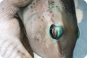
Customary fishing areas provide management authority for customary non-commercial fishing to tangata whenua. The East Otago Taiāpure is a customary protection area established in 1999 due to concerns around decrease in paua stock in the region. The small-scale local management allows for adaptive management through modification of bylaws. Learn how geospatial marine information supports understand the distribution of key kaimoana habitats and inform management of this Taiāpure.
Assisting customary fishery management

Wave and Hydrodynamic models
Find out how a general-purpose model can help scientists better understand our marine environment.
Supporting sustainable maritime activities
Using latest hydrographic technology to understand how vessels can damage the seafloor
Impacts of marine heatwaves on New Zealand Blue Economy
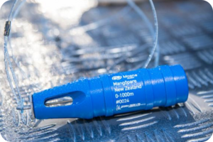
Toitū Te Whenua LINZ has partnered with MetOcean. We are providing historical data collected in the past, and from 2022 we will collect near-real-time ocean temperature and salinity data.
Impact of earthquake on marine ecosystems
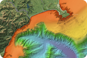
Following the Kaikoura 2016 earthquake LINZ (in partnership with Fisheries New Zealand) commissioned a multibeam hydrographic survey from Cape Campbell to Kaikoura coastline. LINZ updated local charts to keep navigation safe in the area. Scientists still use the data from the survey to understand the impacts of earthquakes on marine ecosystems. This data provides a baseline to gauge the consequences of the earthquake and subsequent recovery of marine resources.

Habitat mapping Queen Charlotte Sound / Tōtaranui and Tory Channel / Kura Te Au
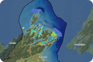
In 2016/2017, Marlborough District Council (MDC) collaborated with LINZ to jointly fund New Zealand’s first multi-disciplinary seabed survey of Queen Charlotte Sound / Tōtaranui and Tory Channel / Kura Te Au. LINZ sought updated bathymetry to identify significant features, navigational hazards, and least depths to update existing charts.
MGI webinars
We leverage the work done through Ngā Poutama Matawhenua - Practical Māori GIS Mapping Wānanga webinar series, to raise awareness of the NZ MGI work programme with iwi/ Māori and support Māori accessing and reusing MGI.
Learn more about Ngā Poutama Matawhenua
Webinar 2
Coming soon - MGI webapp demo – 17 May 2024
