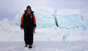
- Qualification and GIS component studying for:
- BSc Advanced Double Major in Mathematics and Biology
- Advanced Diploma in Marine Geomatics
- MEng (Geomatics Engineering)
- Currently studying PGDip in Arts (Geospatial Sciences)
- Tertiary Institute: Massey University via Distance Learning
- Work role: Hydrographic Surveyor at Toitū Te Whenua LINZ. Previously Nautical Cartographer at Toitū Te Whenua LINZ.
What Year 13 school subjects did you take?
French, English, History, Calculus, Mathematics, Chemistry, Biology, Physics
What Secondary School did you attend?
I went to school in Canada.
Why have you chosen to study GIS?
In my job as a Nautical Cartographer at LINZ, I create nautical charts (maps) for mariners using a specialized type of GIS. I’ve chosen to study this PGDip to gain broader GIS skills and knowledge that will help me use our data for much more than just creating charts.
How important is GIS for your future career options, and why?
GIS is obviously a big part of my current job. Learning more on how to analyse and manipulate geospatial data could help me work more widely across LINZ. I am especially keen to develop in Python programming which will help me be more innovative in my work.
What advice would you give to future students considering adding a GIS component to their studies?
Geospatial data benefits a wide variety of fields including conservation, finance, health, education, natural resource management, etc. Learning GIS skills of how to collect, manage, analyse and present geospatial data are transferable and will only open doors to many career opportunities.
Given you are studying GIS part-time via distance learning while working, what tips can you give about studying GIS this way and about distance learning at this time when people are at home because of COVID-19 and may be doing some GIS online learning of their own?
Distance Learning appealed to be because it made it easy to fit course work around my work commitments. Lectures and labs are pre-recorded and available on the course website. This means I’m still able to progress my studies, even though the country’s on lockdown and university classes are suspended. It’s been a great distraction!
Distance Learning does take self-motivation and organization. Some of the tricks I do to ensure I stay on-track are:
- Spend time at the beginning of the semester to review all the class material: I add assignments to my calendar (I use Google Calendar); I make sure I can navigate the course website; I source any textbooks/readings; I make sure I understand how I will be evaluated.
- Block off designated study time in my calendar each week.
- Set specific goals at the beginning of each week – e.g. “This week, I want to complete one lecture, hand in Lab 2, and read one journal article.”
- Ensure I’m chipping away at long-term assignments over the whole semester.