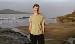
- Qualification and GIS component studying for: Bachelor of Applied Science (Biodiversity Management) that includes Applied GIS course and Final Research Project using GIS
- Tertiary Institute: Unitec
What Year 13 school subjects did you take?
Physics, Biology, History, Statistics, Calculus
What secondary school did you attend?
Tauranga Boys' College
Why have you chosen to study GIS?
I have a knack for using complex software due to my background in photography and videography. Being proficient in using creative software from the Adobe Suite and more gave me the confidence that I could figure out GIS software too. I always enjoyed going down rabbit holes of complex tutorials on YouTube to solve complex tasks in Premiere Pro and After Effects, so why not do the same with Esri software? It has been satisfying to apply the same creative problem-solving skills I developed through photography and videography to solve GIS problems during my studies.
How important is GIS for your future career options, and why?
Using GIS seems to be quite a valuable skill for a variety of areas within biodiversity and ecology, from weed monitoring in field maps to species distribution modelling. It seems that whatever career path I go down, an ability to use GIS will greatly improve my chances of being selected and enhance my ability to do my job effectively.
How has studying GIS shaped your career goals?
I have been developing an interest in urban ecology and understanding the relationships between human-dominated systems and natural systems. I have found that a lot of the studies in this growing profession utilise GIS frequently.
What advice would you give to future students considering adding a GIS component to their studies?
Give it a try. Introductory courses to GIS aren't too difficult, so can give you a good taste of what it can lead to. Especially if you have previous experience using other complex or creative software, you'll pick it up very fast!
Last year you applied successfully for a Toitū Te Whenua LINZ external tertiary GIS scholarship. What difference has this made to you and your GIS study courses?
It has been very motivational to push ahead with my studies, especially with this being my first scholarship. It is great to be recognised and rewarded for doing something that is at the same time going to be so valuable to my career moving forward.