You are viewing guidance that refers to, or is for Legacy Landonline.
Filtering vectors
Information about filtering vectors in Landonline.
By filtering vectors in Landonline, you can:
adopt vectors for a cadastral survey dataset from existing data in Landonline
adopt a previous survey for a Parcels Without Survey Information CSD (PWSI CSD), and
show only vectors for a specific plan.
How do I filter a vector?
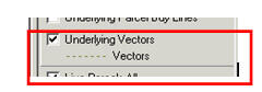
Go to the Landonline – Survey Capture Screen (CSC S10 – Spatial Display). Turn on Underlying Vectors (or make it the active layer if already turned on).
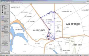
All underlying vectors will display as grey dashed lines (see example below).
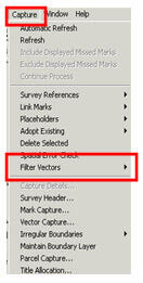
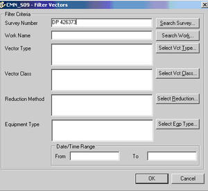
Now select Capture – Filter Vectors.
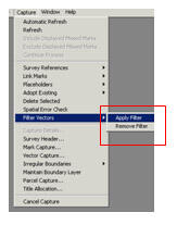
Then, to the right, select Apply Filter.
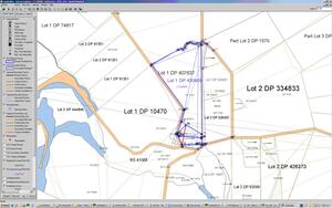
In the Filter Vectors screen that now appears, enter the survey number you wish to display. Select ‘OK’ (in this example DP 426373 has been entered).
The filtered Vectors layer will show only Vectors captured by that survey allowing you to easily adopt Vectors from that survey.