
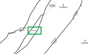
Erosion parcels are captured spatially as separate parcels in Landonline - the extinguished primary parcel is divided into 2 new primary parcels: a ‘dry’ primary parcel, and a ‘wet’ primary parcel.
See also:
How to capture an erosion parcel
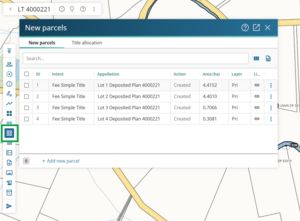
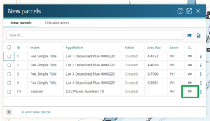
Select New parcels in the Workflow control bar to open the New parcels panel.
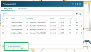
Select + Add new parcel.
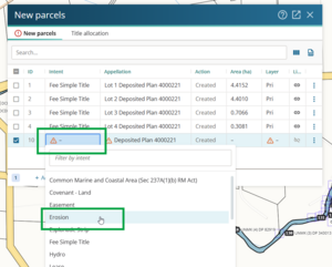
Double-click the Intent field for the new parcel. Select Erosion from the dropdown list.
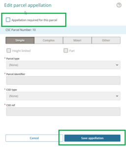
Open the Appellation panel by double-clicking in the Appellation field for the new parcel.
Untick Appellation required for this parcel. The remaining fields will change to grey. Select Save appellation.
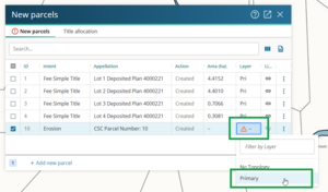
Double-click the Layer field for the erosion parcel. In most cases the layer will be Primary. Select Primary.
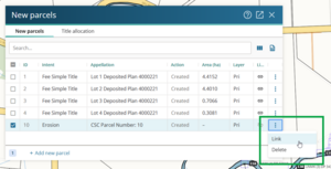
Left-click the 3 dots at the end of the row. Select Link to link the parcel.
Left-click to select the parcel in Spatial view. The selected parcel will turn pink. Click Link Parcel.
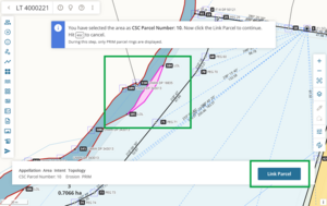
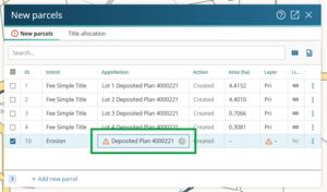
The new erosion parcel is now linked in the New parcels panel.
In Plan Generation, in the layout plan sheets, add the word ‘Erosion’ as user added text to the Diagram of parcels.


For information on how to add a label in Plan Generation, see:
Add label